snow report

Mid Winter Catch Up

My blog has been a little quiet recently, mostly due to being very busy teaching and riding. This winter has seen some wild weather and crazy conditions, with huge amounts of snowfall, but also high winds, and even lots of rain! Thankfully now things seem to have calmed down, the pistes are in great condition after a recent snowfall, and the temperatures are remaining below zero, stopping the snow from melting and re-freezing.

26184636_402920233493546_9162885226446192640_n.jpg

Here I am trying to find the best snow amongst some challenging conditions off piste a few weeks back.

26367001_946446332185004_5722891381861515264_n.jpg

Things improved the next week, but the icy layer was still present under the powder.

26863957_146478959373488_2453914588018638848_n.jpg

This one from a few days ago shows how conditions off piste have stabilised, allowing us to ride steeper terrain. Here I am looking back up towards the 'Fingers' as Alex is skiing down. This south facing line had been in the sun all day and began to soften up in the afternoon. On the north faces the powder remained cold, light, and fluffy.

Graupel keeps falling on my head

20171208_164016-01.jpeg

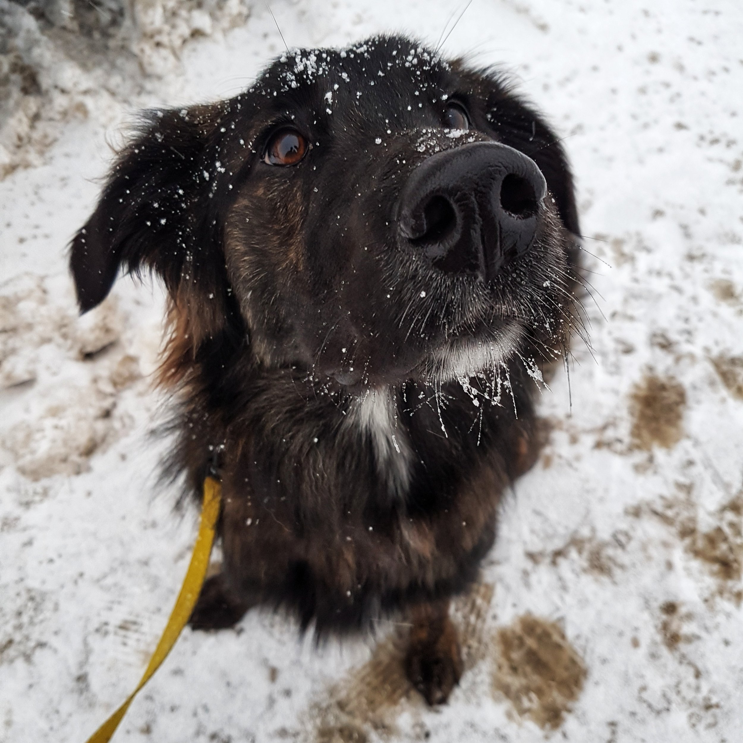
Whilst walking my dog Indy this afternoon, I noticed the snow change from fluffy crystals to small hail like snow. Looking a bit like Styrofoam balls they stuck to Indy's back and head. This type of precipitation is called Graupel.

Graupel is formed when the temperature in the clouds drops to around -40°C. Under the right atmospheric conditions snow crystals collide with super-cooled water droplets. The water then freezes around the snow crystal, forming the small balls you see on Indy's head. Hail is very hard and icy, whereas graupel is a soft and almost sticky kind of snow.

It is important to notice graupel as it can be a contributing factor to avalanches. The little balls stack up on the snow like a layer of marbles. When the weather turns back to snow this layer becomes buried in the snowpack. As you can imagine it then becomes very easy for the snow to slide off this 'layer of marbles'. Fortunately, graupel quickly begins to compact and loose its shape, stabilising in the snowpack after a couple of days. So just be aware and avoid any steep slopes for the next two days, the graupel is lurking!

It's on like Donkey Kong!

After 3 years of terrible starts to the winter, Alpe d'Huez is finally covered in snow, ready for opening day tomorrow! 


As you can see from this quick run this morning, there's plenty of snow already in town, I can't wait to see how conditions are looking up on the glacier! 

Contact me at malcolm@masterclasssnowboarding.com to book your English Snowboard Lessons this winter! 

King Winter

Over the course of the season I spend alot of time looking at freezing levels. The town of Alpe d'Huez is at 1800m and the highest lift at Pic Blanc is 3300m. The lower the freezing level the better!

This week we have seen the freezing level stay consistently below 500m, bringing cold temperatures to the town, and allowing the resort to get ready for the season! 

The cold temperatures mean the existing snow doesn't melt, the snow cannons can keep firing, and whatever snow does fall is light and fluffy!

As you can see by the photo below there's already been a decent amount of snow come down this week, the clouds quickly rolled back in after I took this shot, and more snow is due over the next few days.

After a very slow start to winter last year I am very excited to get riding and see this season off to a fantastic start. The chairlifts open this weekend in Alpe d'Huez, however if the sun does make an appearance before then I'll be sure to go for a hike in order to make some pow turns!

upload.jpg

#winterscoming